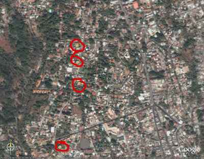
Our language school (from space)
When we first move to Mexico, we’re going to be spending time in ministry and study in Cuernavaca. Would you like to see our language school? Well, thanks to the wonders of satellite imagery you now can!
The Universidad Internacional is actually a series of buildings going up and down the street. You can see the area in the photo below, but if you want a closer up view click on the photo to go to our photo album. There you’ll be able to see it full size.

Better yet, if you have your own copy of Google Earth (free Google Earth download) you can download the locations of the UI buildings, plus links to pictures of each building! If you use the Google Earth file, you’ll be able to zoom out and see the interesting layout of the city. You can see to the west of the school the “fingers” (green, deep valleys) that split up the city. Here’s the file: Universidad Internacional for Google Earth
Someone else has created a Google Earth file of many of the main buildings in Cuernavaca. Check here for the Cuernavaca file.
There were some pictures of our language school in our August 2005 newsletter, and they’re online in our gallery – language school 1 and language school 2. These were both taken in the main area of the language school (buildings 1-9), not far from where you’ll see the marker in Google Earth.
